Finally create your own maps
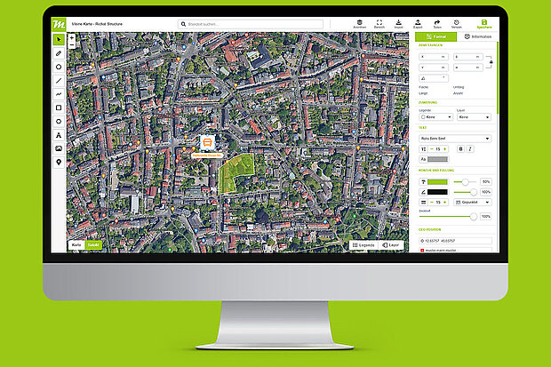
Create sketches based on Google Maps in no time with the comfortable map editor. Numerous tools and functions are available in the editor. Now you can put an end to the time-consuming old-fashioned method of creating maps. Areas, dimensions and distances are supplied with the map.
Sketches on Google Maps
With miamapo you create your own sketches based on Google Maps / Earth, OpenStreetMap, Bring or others. With the miamapo map editor this becomes a piece of cake. All you need is an internet browser.
Export maps
Each map can be quickly exported in the different file formats. The following formats are available: PDF, PNG or JPG. This way you can easily use your maps in other applications.
Mass determination
The editor automatically calculates the area, perimeter or length of rectangles, circles, polygons or polylines. You can then use this data, for example, for quotations or invoices.
Sharing and
collaboration
Each map sketch can be easily shared with colleagues, customers or friends via link. You can define on your own if the map can only be viewed or if it can also be modified.
Integration in business applications
miamapo offers numerous APIs that allow any business application to create, modify and display miamapo maps directly in the application or to use the determined masses for offers.
Storage and data protection
Your maps are stored exclusively on the servers of miamapo. These servers are located in Germany and are therefore subject to the strict data protection regulations of the DSGVO.
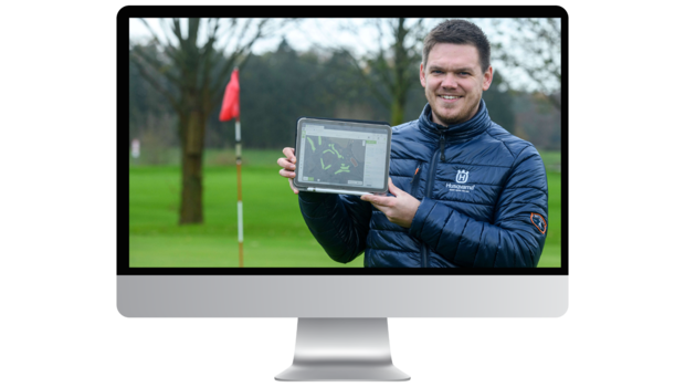
Digital Maps for Golf Courses - a success story
Where does the mowing need to happen? How large are the areas? How many lawn mowers are required? Many details go into planning the lawnmowers on the golf course, and Budde maintains an overview with miamapo.
"That's the advantage of miamapo: I can start working with it right away, have everything I need, and navigate swiftly with the tool," says Andre Budde. Before Budde and his colleagues started using miamapo for project planning, they used Google Maps. "But miamapo is more intuitive, flexible, can be customized individually, and comes with features that are crucial for communication."