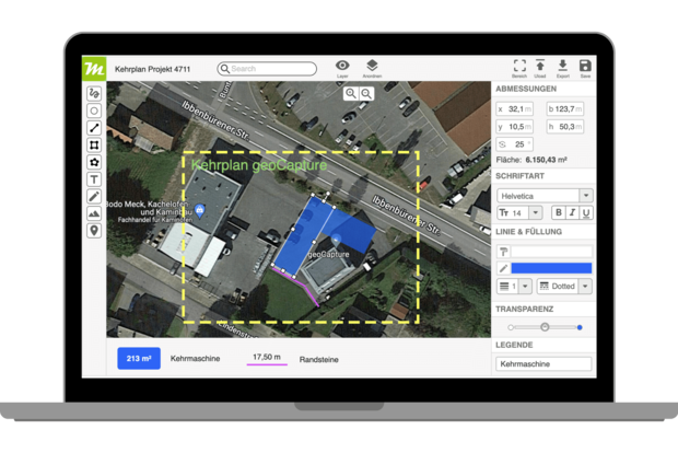
Map Editor
The map editor is the central tool of miamapo. With the editor you can create your own map sketches in no time. The editor runs in your browser, you don't need to install any additional software. Due to simple and intuitive handling you can start immediately and without training. You can create sketches on street maps or satellite maps. The editor can also be used with the Apple stylus.
Drawing tools
In the map editor, numerous useful tools help you to design your map:
Circles
Rectangles
Polygons
Lines
Colours/Transparency
Text/Fonts
Layers/Legends
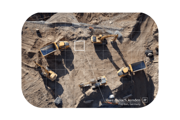
Graphics/photos/dronen shots
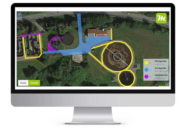
Mass determination
miamapo determines area, length, circumference or volume for you completely automatically and so precisely that you can use these masses as the basis for quotations or invoicing in your ERP system. This data can be transferred directly from your ERP system to miamapo via the miamapo API.

Import of your data
Using the import interface you can easily use your own data in the sketches. Use your own symbols and icons, building floor plans, architect plans, drone footage or photos. With the POI Importer (Point Of Interest) you can import your own address or GPS data as CSV or Excel and display it on the map.

Export map data
miamapo offers numerous formats for data export.
Vector formats: PDF, SVG
Graphic formats: JPG, PNG
Data formats: JSON, XML (incl. masses)
All data formats are also directly accessible via miamapo REST API.

100% cloud, 100% secure
The operation and storage of miamapo runs 100% in the cloud. So you have access to your maps from any device with a browser. You don't need to install any extra software or App. Your maps and data are safe with us. They are stored exclusively on servers in Germany and are subject to the strict German data protection regulations. Strong encryption additionally prevents unauthorized access.

Collaboration with colleagues or customers
Every map you have created with miamapo can be shared with friends, colleagues or customers. Simply send a link to your map via email, WhatsApp or other media. You can decide whether your map can be viewed or even changed. Of course you can also send your maps as a file (PDF, JPG, PNG, JSON).
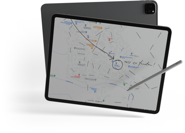
What3Words – 3 word navigation
In many cases a postal address is not sufficient for navigation. In new building areas, sports grounds, building plots, forest and meadows, campsites or even at festivals what3words helps. With it every place in the world is described with the help of 3 words. Miamapo provides the corresponding what3words coordinates for each object, so that position information is easy to read.

APIs for software developers
The miamapo API provides numerous REST interfaces for connecting other software. This allows the full functionality of miamapo to be used in any application. You can use these APIs:
Call map editor in WebView
Call map viewer in WebView
Export maps as PDF, JPG, PNG, SVG, JSON
Get mass measurements (area, outline, length, volume)
Map management
Administration of users
Administration of accounts/customers
Microsoft AZURE (single signon, user)